Hierarchy Properties
Overlays set in Discover by non-Admin users are configured individually and are visible only to the user who set them. However, admins can set overlays per user role in both Discover and in the Admin console.
Hierarchy Properties Dialog
To access the properties dialog, right click on the required hierarchy and click Properties from the context menu.
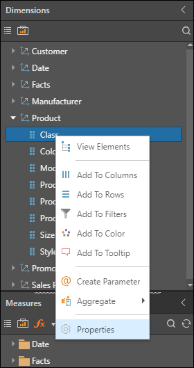
The dialog presents the user with the following options:
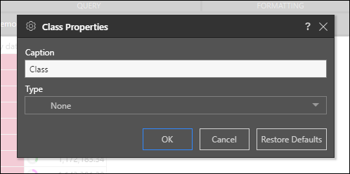
Caption: the caption designated to the given dimension hierarchy. Edit the caption as required.
Type: the category assigned to the given dimension hierarchy. Select a different type from the drop-down menu.
Restore Defaults: restore the hierarchy's default properties.
Click OK to confirm your changes.
Example
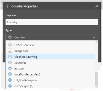
When custom maps are configured in the Admin console, they will appear in the Type drop down in data models containing a geography hierarchy with the same keys as the custom map file that was imported.
There may be multiple custom map files, and you may want to connect to different files to create different custom maps. To do this, simply open the Properties dialog for the appropriate geography hierarchy and select the required custom map from the Type drop down.
You can also change the hierarchy caption, to reflect the custom map that was selected.
For instance, here you may want to select the custom map file called "europe" and change the hierarchy's caption to "Europe".